")
This map will focus on plotting properties where present day North Carolina counties of Johnston, Harnett, and Wake come together, about 2 miles northeast of Angiers, North Carolina.
Starting off in the NE quadrant of the map, the first tract to review is one granted to William Eason in 1755.
William Eason – 359A issued on 9 May 1755 (14s 4d 1/2d quitrent) – located on the North Side of the South Prong of Black Creek (nclandgrants.com). William Eason’s survey was completed on 12 July 1754 and the chain carriers were listed as James Nolleboy and Joseph Messer.
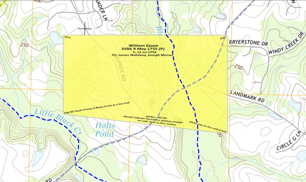
Sam’s Law: {a fun twist similar to Bacon’s Law} James Nolleboy is likely the same James Nolliboy of Lower Parish Isle of Wight, Virginia (not proven) that in 1713 was deeded a 170A tract of land by Needham Bryan and wife Anne of the Upper Parish of Isle of Wight. (IOW 2:265) Needham and Anne’s sons, Needham and William, married sisters Nancy and Elizabeth Smith, daughters of John Smith Sr of Johnston County, North Carolina. John Smith’s apparent brother is Samuel Smith Sr.
Then seven and a half years later Jesse Page receives 517A issued on 1 January 1763 (20s 8d 1/2d quitrent) – located on both sides of Black Creek (nclandgrants.com). Jesse Page’s survey was completed on 1 December 1762 and the chain carriers were listed as Richard Smith and Francis Payne.
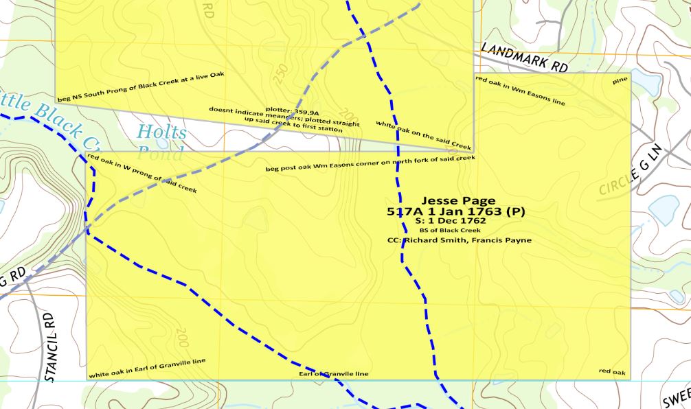
This Richard Smith is likely the same Richard Smith that lived in Cumberland County, NC and migrated to Georgia (Hardy Smith, Francis Scott Smith, Job Smith). I have previously indicated that my working theory is Needham Smith was born ca1762 and could be the son of Richard Smith who migrated to Wilkes County, GA. That would lend to speculate that Richard Smith would have been at least 20 years old when Needham was born. Richard therefore would have been born before 1742.
In examining Jesse Page’s survey, Richard Smith should have been at least 21 years old. With a survey date of 1 December 1762, this still supports the working theory that has been presented.
Next, knowing that in almost all cases, chain carriers were either relatives of the new property owner, adjacent/neighboring land owners, or individuals hired by the surveyor, a closer examination into these chain carriers is warranted at some point.
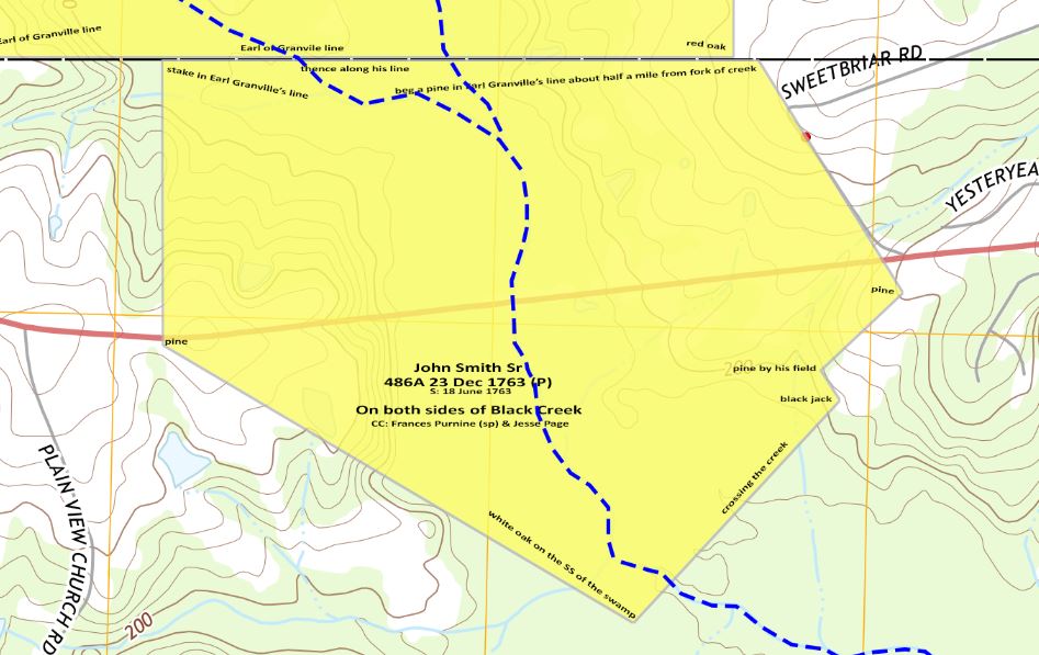
Close to 11 months after Jesse Page’s survey, John Smith Senior receives 486A issued on 23 December 1763 – located on both sides of Black Creek (nclandgrants.com). John Smith’s survey was completed on 18 June 1763 and the chain carriers were listed as Francis Purnine (probably Francis Payne) and Jesse Page.
Sam’s Law: John Smith Senior is the apparent brother of Samuel Smith Senior of Johnston County.

Leave a comment