")
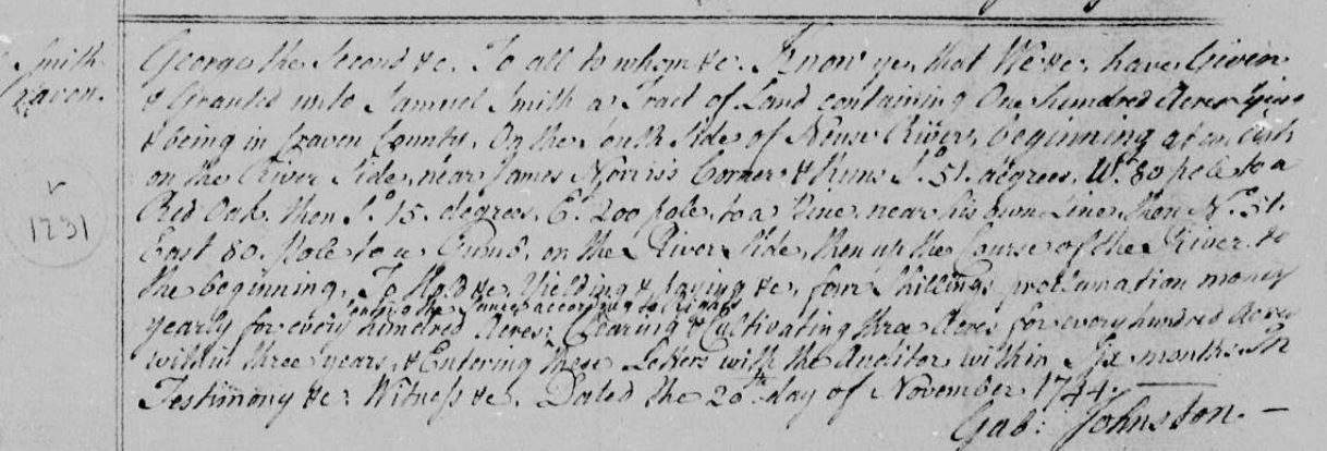
“…. unto Samuel Smith a tract of land containing one hundred acres lying & being in Craven County, on the south side of Neuse River beginning at an ash on the river side near James Norris’s corner …. to a pine near his own line …. to a gum on the river side then up the course of the river to the beginning ….”
Plotting this parcel and matching it up to the surrounding plots has been a challenge. I should introduce a 250 acre patent that Samuel obtained in 1756 (Johnston County).
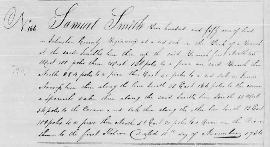
“Samuel Smith two hundred and fifty acres of land in Johnston County, beginning at a red oak in the fork of a branch at the said Smith’s line then up the said Branch …. to a red oak in James Norris’s line …. to the corner a Spanish oak then along the said Smith line …. to the corner a red oak then along the other line ….to a gum on the River then to the first station ….”
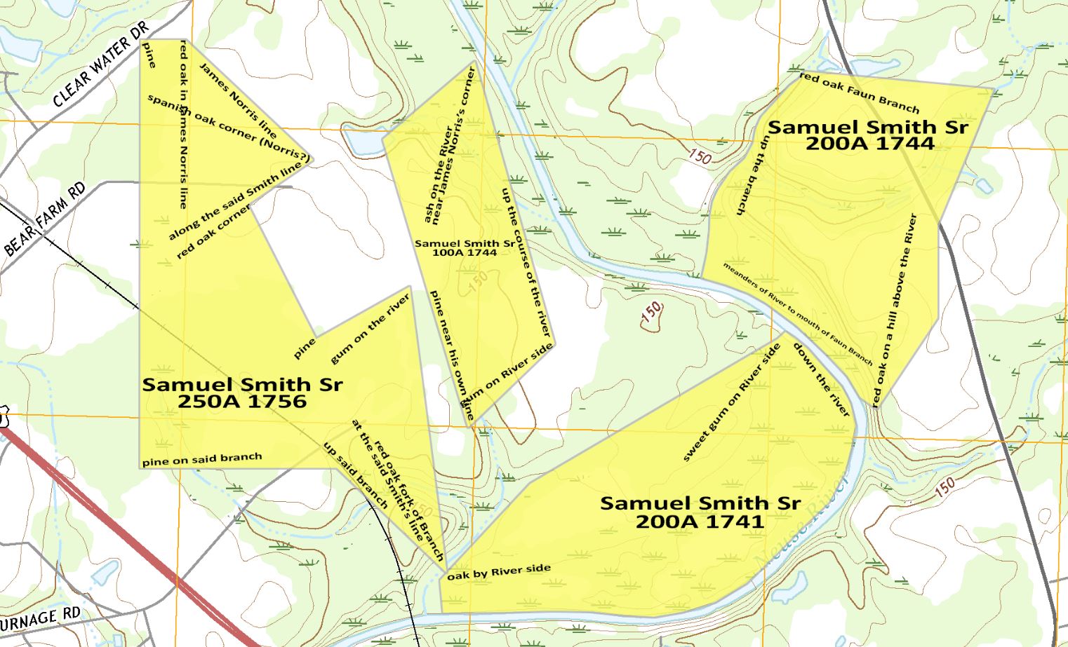
Based on the language in the 250A patent and a 1777 deed, from senior to junior, it would appear that the 100A parcel joins the 250A parcel in the square cutout on the right side of the 250A plot. And that west side of the parcels should be lying near the river.
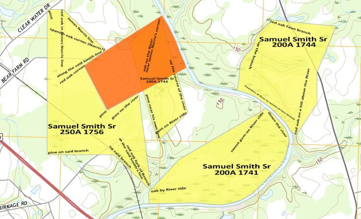
I’m unable to locate the survey for either parcel so it is a small challenge to properly plot them. A theory I’m working on, is it possible that the transcribing from the survey to the patent books are incorrect, which is causing a possibly irregular shape of the 100A parcel. The orange section below is what 100 acres plots to the river (a theory that I’m working with).
I do believe the 250A plot is properly placed as will be shown in a future entry.

Leave a comment