")
“…. unto Samuel Smith two hundred acres of land lying in Craven County on the south side of Neuse River beginning at a red oak by the river side …. to a sweet gum on the river side then down the river …. “
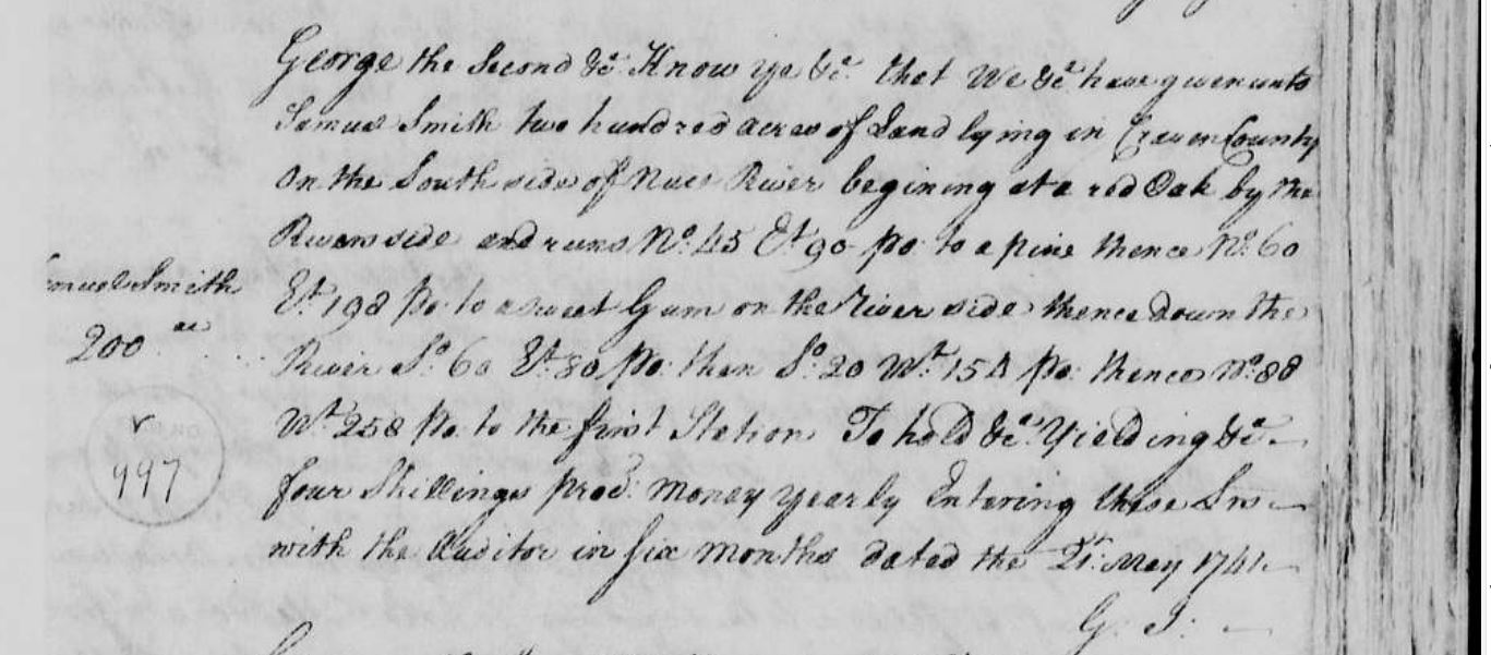
This is likely the earliest ‘issued’ patent for Samuel Smith Sr, Craven County. Considering the process and length of time to go through the entry, warrant, survey, patent process and have a patent ‘issued’, which could take several years, it’s conceivable that Samuel came to the area around 1738 with his brother or possibly a year later to settle in the area and make an entry for land.
Here is an abbreviated read on the North Carolina Land and Property history.
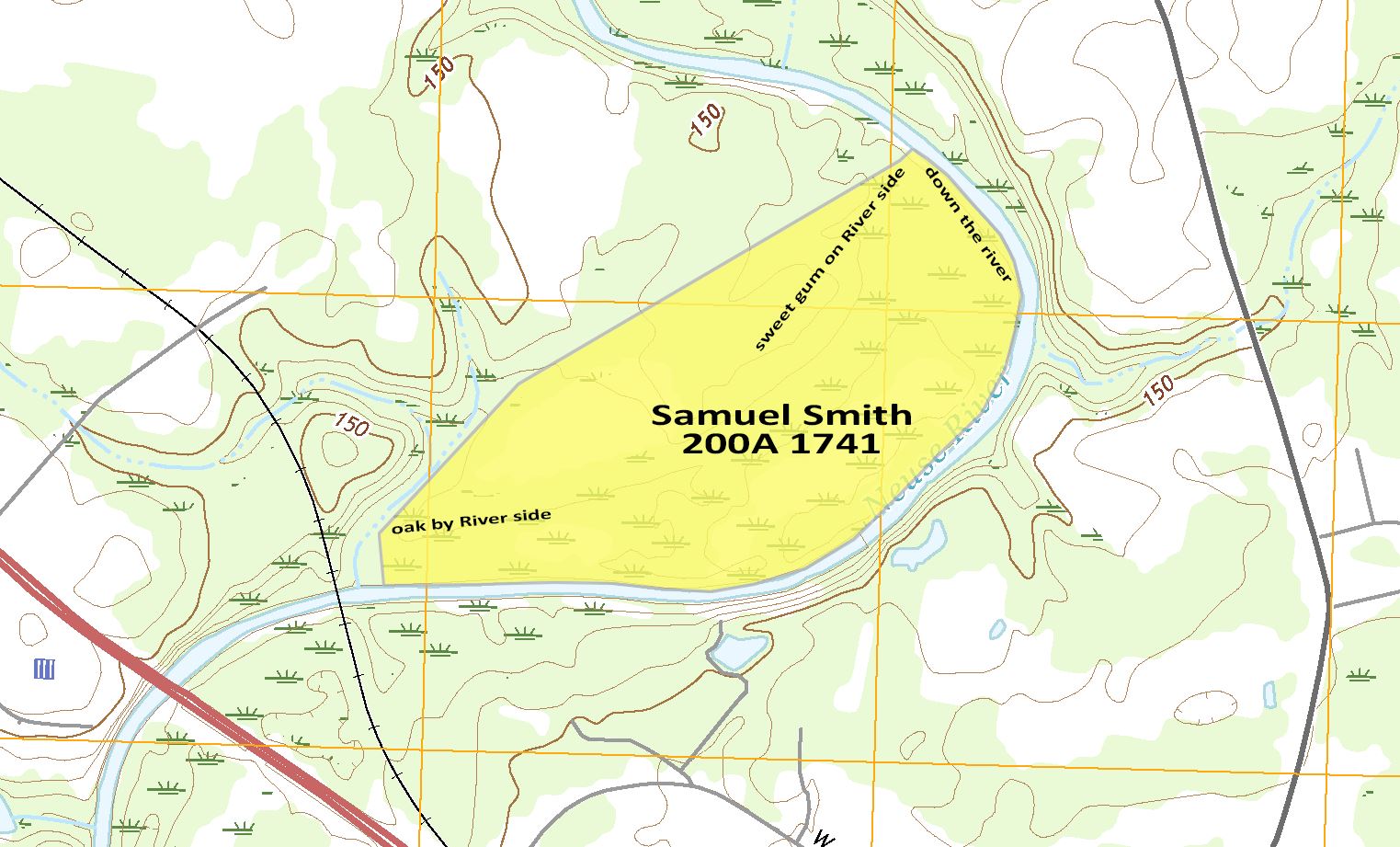
So I assume this parcel of land is on the river in the vicinity of Smithfield (history of Smithfield, North Carolina and it’s founder John Smith Jr.). Plotting the parcel it appears to lay to the west of Bear Farm Road, Smithfield, NC and on the east/south side of the Neuse River.
The wording of the patent does not define that it follows the meanders of the river however the three legs that follow the ‘sweet gum on the river side’ do follow the general flow of the river back to the first station. My plot of this patent therefore will follow the meanders of the river, nicely contoured to 200 acres, as plots of the three legs defined in the patent adds 30 plus acres to the parcel and causes the parcel to extend across the Neuse River.
I have to mention at this point that I have followed the exceptional patent mapping work done at Andersons of Colonial N. Carolina, which has given me the enthusiasm to try and map the Smith’s and neighbors in Johnston County, with hopes to get a clearer picture of the branches in my Smith Family Tree.

Leave a comment